Reducing Shoreline Erosion the Right Way in Akeley
October 16, 2025
October 16, 2025
Waves eating away at your shoreline can feel like losing your yard, a little at a time. If you own lakefront in Akeley, you want solutions that protect your property, keep the water clear, and meet local rules. The good news: you can often fix erosion with natural methods that look great and may even qualify for cost-share funding. Here is how to choose the right approach and who to call before you start. Let’s dive in.
Wind and boat waves hit our Hubbard County lakes hard. Over time, that energy undercuts banks and pulls soil into the water. Winter adds pressure as ice pushes and creates ridges that can scour the shore.
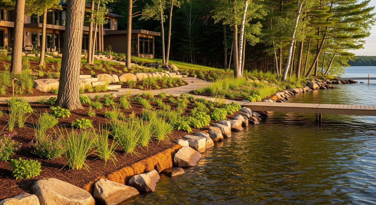
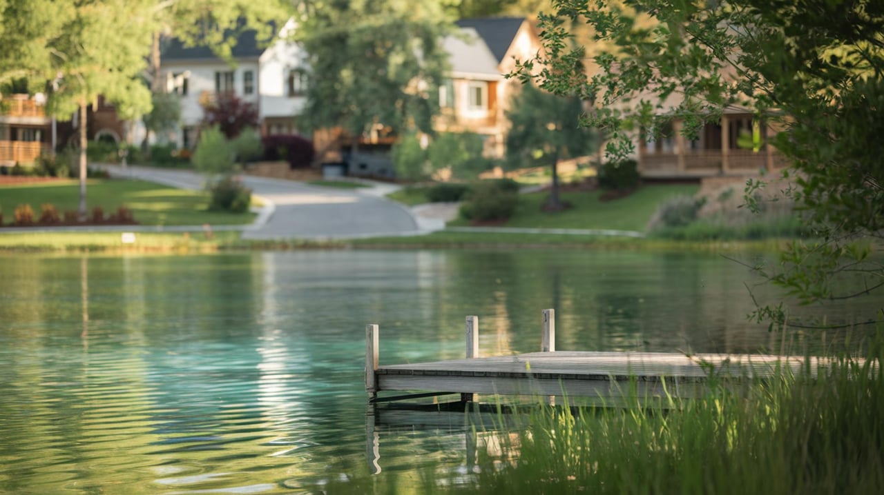
When turf runs to the water’s edge, shallow roots cannot hold soil. Replacing some lawn with deep-rooted native plants improves stability and water quality, and it looks natural over time. The Minnesota DNR explains how natural shorelines resist erosion and reduce maintenance in its guidance on maintaining and restoring natural shorelines (DNR lakescaping guidance).
Runoff is another driver. Hard surfaces, roof downspouts, and ditches can send fast-moving water to one spot on your shore. The Minnesota Stormwater Manual recommends spreading flow into a vegetated buffer and using simple design tweaks to slow water before it reaches the lake (Stormwater Manual buffer guidance).
Before you plan work at the water’s edge, call the local authorities who oversee shoreland projects:
Minnesota also requires vegetated buffers along mapped public waters. The state standard is a 50-foot average width with a 30-foot minimum of perennial vegetation unless your shore is covered by shoreland standards (Minnesota buffer statute). Buffers stabilize banks and filter runoff, so they are both smart and often required.
The DNR and local SWCDs favor natural methods because they protect habitat and diffuse wave energy while keeping your shoreline attractive.
A multi-layer buffer of grasses, sedges, shrubs, and trees binds soil and slows runoff. Aim for a wide, functional buffer. Many guides and the buffer statute point to about a 50-foot average width, with a minimum of 30 feet on mapped public waters. For plant lists and layouts that fit northern Minnesota, use the DNR’s Restore Your Shore tool (Restore Your Shore).
Redirect downspouts, break up concentrated flow, and let water spread into your buffer. Keeping runoff shallow and slow reduces the energy that causes washouts. The Minnesota Stormwater Manual outlines practical ways to grade for sheet flow into buffers (Stormwater Manual buffer guidance).
Coir (coconut fiber) logs, willow live stakes, brush bundles, and similar practices stabilize the toe of the bank while new roots take hold. Many hand-installed bioengineering projects can proceed without an individual DNR public-waters permit if the SWCD and DNR review the design and specific conditions are met (DNR public waters permits).
Emergent and submergent plant beds can reduce wave energy once established. If you plan to plant or remove aquatic vegetation below the Ordinary High Water Level, contact DNR Fisheries first because separate rules apply (DNR public waters permits). Research shows protected plantings can meaningfully cut wave energy at the shoreline (study on wave-barrier plantings).
Some sites have active erosion that needs hard protection. Properly designed riprap can be appropriate, but it must meet DNR criteria and may require permits. Key design limits include:
These details help the riprap work and prevent new problems next door. Review the DNR’s permit guidance before you hire a contractor (DNR public waters permits).
The Hubbard County SWCD offers technical assistance and cost-share for eligible shoreland stabilization projects. Many programs commonly cover a portion of project costs, often around half, but amounts and eligibility change. Contact the SWCD to confirm current options and start the application process (Hubbard SWCD programs). Hubbard County Environmental Services is your source for local permits and shoreland ordinance updates (Hubbard County Environmental Services).
Protecting your shoreline the right way safeguards your property, your lake, and your long-term value. If you are weighing improvements before listing or want guidance while shopping for lakefront, connect with Sheila Johnson for local, results-focused advice tailored to Akeley’s shoreland rules and market.
Stay up to date on the latest real estate trends.

Lifestyle
Explore the Top Picks for Coffee Lovers in Bemidji

Real Estate
Maximize Your Property Value with Smart Renovations

Real Estate
Exploring the Latest Innovations for a Smarter Home
Lifestyle
Discover the Thrill of Hackensack: A Guide to Local Gems
Real Estate
Essential Tips and Insights for the Bagley Homebuyer
Real Estate
Strategies to Increase Your Home's Value and Equity in Bagley
Real Estate
Key Factors to Consider for Your Ideal Cass Lake Community
Real Estate
Essential Advice for Navigating the Hackensack Real Estate Market